This post marks the publication of a work on helicopter-borne infra red images orthorectification.
Paugam, R.; Wooster, M.J.; Mell, W.E.; Rochoux, M.C.; Filippi, J.-B.; Rücker, G.; Frauenberger, O.; Lorenz, E.; Schroeder, W.; Main, B.; Govender, N. Orthorectification of Helicopter-Borne High Resolution Experimental Burn Observation from Infra Red Handheld Imagers. Remote Sens. 2021, 13, 4913. https://doi.org/10.3390/rs13234913
The manuscript is available here in open access on the MDPI website.
Associated results are present on 3DFireLab website here.
The abstract is reported below:
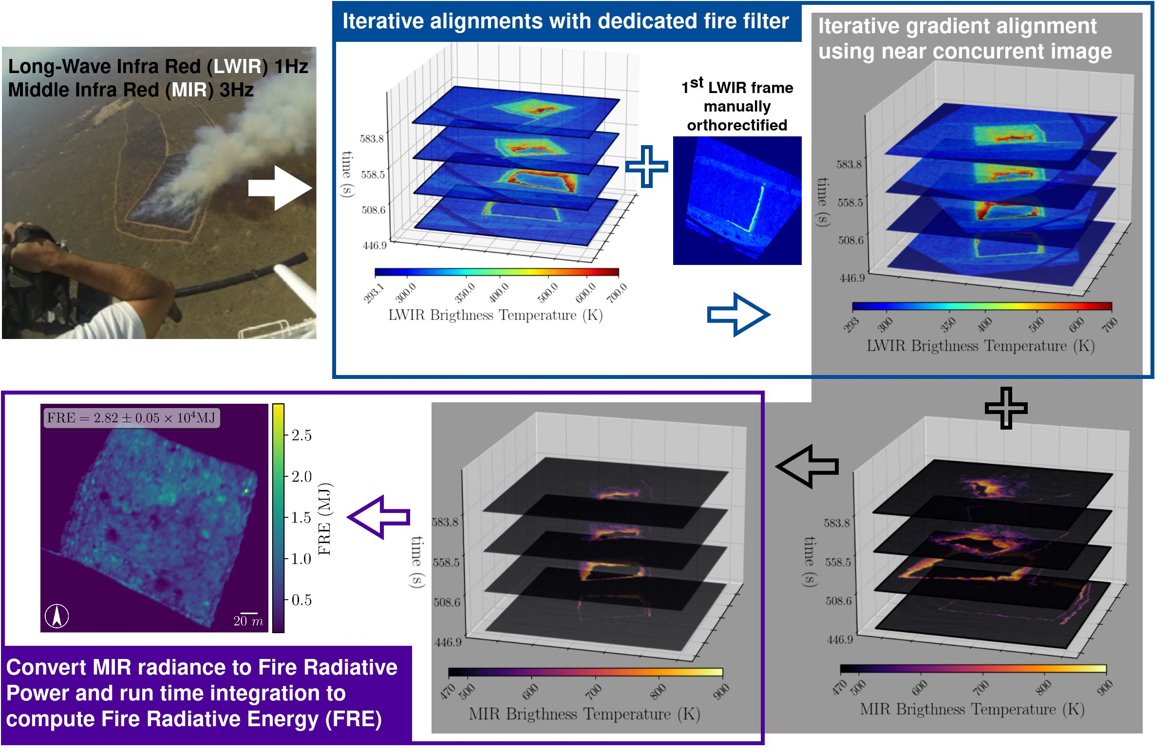
To pursue the development and validation of coupled fire-atmosphere models, the wildland fire modeling community needs validation data sets with scenarios where fire-induced winds influence fire front behavior, and with high temporal and spatial resolution. Helicopter-borne infrared thermal cameras have the potential to monitor landscape-scale wildland fires at a high resolution during experimental burns. To extract valuable information from those observations, three-step image processing is required: (a) Orthorectification to warp raw images on a fixed coordinate system grid, (b) segmentation to delineate the fire front location out of the orthorectified images, and (c) computation of fire behavior metrics such as the rate of spread from the time-evolving fire front location. This work is dedicated to the first orthorectification step, and presents a series of algorithms that are designed to process handheld helicopter-borne thermal images collected during savannah experimental burns. The novelty in the approach lies on its recursive design, which does not require the presence of fixed ground control points, hence relaxing the constraint on field of view coverage and helping the acquisition of high-frequency observations. For four burns ranging from four to eight hectares, long-wave and mid infra red images were collected at 1 and 3 Hz, respectively, and orthorectified at a high spatial resolution (<1 m) with an absolute accuracy estimated to be lower than 4 m. Subsequent computation of fire radiative power is discussed with comparison to concurrent space-borne measurements.